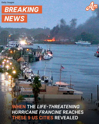
A dangerous tropical storm, Francine, is rapidly gaining strength and heading straight for the coast. Coastal communities are on high alert as experts warn of potential hurricane-force winds and heavy rainfall.
Hold onto your hats – or better yet, your roof shingles – because Tropical Storm Francine is aiming for the U.S. coast. As of early Tuesday, the storm was brewing in the Gulf of Mexico with wind speeds already clocking in at a fierce 65 miles per hour, according to the National Hurricane Center.
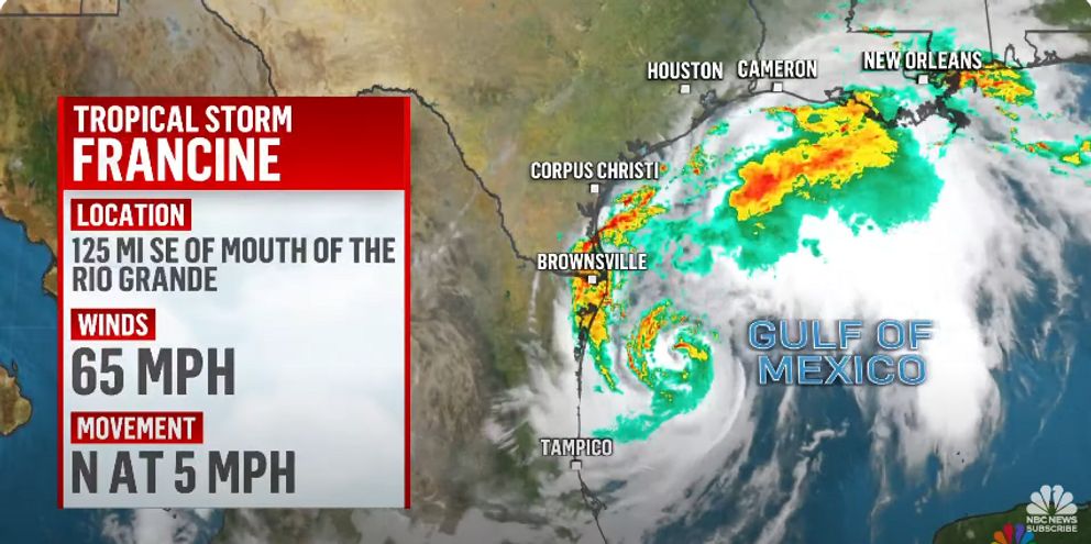
And those winds aren’t just breezy – they’re downright destructive. With sustained winds like these, you’re looking at a very serious situation. Winds that hit 58 miles per hour – which Francine has already surpassed – can tear through tree limbs and send roof shingles flying through the air.
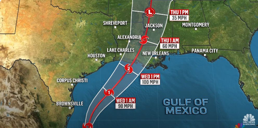
Anything stronger, and you’re staring down hurricane-force winds, starting at a brutal 74 miles per hour. So when and where will Francine make her grand (and uninvited) entrance? Here’s what we know:
Port Isabel, Texas is bracing for impact as early as 9 a.m. today, with a more likely storm surge around 11 a.m.
Galveston, Texas can expect Francine to come knocking by 7 p.m., but she might decide to wait until the early hours of Wednesday around 2 a.m.
Over in Port Arthur, Texas, the winds will likely howl around 1 a.m. Wednesday, with more severe damage possible by 8 a.m.
Grand Isle, Louisiana isn’t off the hook either, as it’s looking at gusts by 7 a.m. Wednesday with full storm power unleashed by noon.
Lake Charles, Louisiana is facing similar timing, with strong winds arriving around 8 a.m. and continuing through noon.
Further inland in Lafayette, Louisiana, there’s a whopping 51% chance of damaging winds by 11 a.m. Wednesday, with things ramping up by 2 p.m.
As for Kenner and Alexandria, Louisiana, Francine’s impact will be felt from noon to 5 p.m. Wednesday, while Baton Rouge should prepare for the worst between 2 p.m. and 5 p.m.
Southern Louisiana is on high alert as local officials race against time, preparing for Tropical Storm Francine, which is predicted to make a dramatic landfall on Wednesday as a hurricane.
With the potential for heavy rainfall and a dangerous storm surge looming large, preparations across the region are in full swing. Local crews have been hard at work clearing storm drains and distributing sandbags, bracing for what could be a fierce hit from Mother Nature.
Residents have been urged to take matters into their own hands and start prepping. This comes as the storm rapidly approached hurricane strength less than a day after forming in the Gulf of Mexico.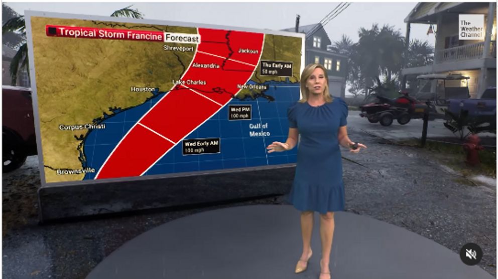
Mayor-President of Baton Rouge, Sharon Weston Broome told locals to take safety measures during a Monday news conference. “It’s crucial that all of us take this storm very seriously,” Broome emphasized.
Broome advised residents to put together disaster supply kits with enough food and essential supplies to last at least 72 hours. She also stressed that before Francine hits, everyone in the area should have a solid plan and be ready to hunker down in a sturdy structure.
“When this storm starts affecting our area on Wednesday, I want everyone in East Baton Rouge Parish to have a plan to be inside a sturdy structure for the duration of the storm,” Broome added.
Furthermore, the National Hurricane Center has sounded the alarm. The agency stated that Tropical Storm Francine is expected to intensify into a Category 2 hurricane before it crashes ashore on Wednesday.
With storm surges potentially reaching up to 10 feet and rainfall totals of up to 12 inches, Francine isn’t holding back. This storm means business. As Francine prepares to unleash her fury on the Gulf Coast, the residents of Texas and Louisiana are being urged to stay vigilant.
Whether you’re near the coastline or further inland, it’s time to keep one eye on the sky – because Francine’s coming, and she’s bringing all the wind she can carry.
